In May 2026 we commenced a new project on East Lothian’s River Tyne called ‘Restoration Tyne’. We are inviting those with knowledge of this catchment to feed this into our evidence gathering process. Please feel free to make contact with us to offer your local insights.
Rivers are the blue-green arteries of our landscapes, providing water, nutrients and vital wildlife corridors through some of our most intensively managed environments. Yet many rivers have been modified over time. They have been straightened, embanked, deepened and re-engineered to act as efficient drains to move water off the land as quickly as possible.
As climate change brings more frequent and intense rainfall events and prolonged periods of drought, these altered river systems contribute to increased flood risk downstream, threatening communities and causing significant economic damage. At the same time, many rivers have lost their riverside woodlands and continue to face pressures from agricultural runoff and sewage pollution.
Fortunately, river restoration projects across the UK are demonstrating how these challenges can be addressed. Measures such as riverside tree planting, wetland creation, natural flood management and wider buffer strips can improve water quality, enhance wildlife habitats and reduce flood risk. When delivered at a catchment scale, these interventions can deliver benefits throughout an entire river system.
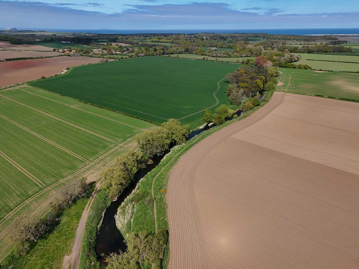
The River Tyne Catchment
The River Tyne Catchment in East Lothian covers approximately 300 square kilometres, draining a diverse landscape of upland moorland, farmland, woodland and settlements before reaching the Firth of Forth at Tyninghame, near Dunbar.
The catchment is formed by the confluence of the Tyne Water and Biel Water and includes a network of tributaries that support a rich variety of habitats and species. The river system plays an important role in local ecology, agriculture, recreation and water management, while also facing challenges associated with flooding, water quality, intensive agricultural landuse and habitat degradation.
Help Shape the Future of the River Tyne through ‘Restoration Tyne’
As part of its Muir to Forth initiative, East Lothian charity Balanced Horizon, in partnership with the Forth Rivers Trust, has been supported by funding from the Nature Restoration Fund, managed by NatureScot, to explore restoration options for the River Tyne catchment. strengthen ecological networks and reduce flood risk across the Restoration Tyne aims to identify where river restoration measures could improve water quality, catchment.

Local knowledge is essential to this work, and we would like to hear from anyone who knows the catchment well.
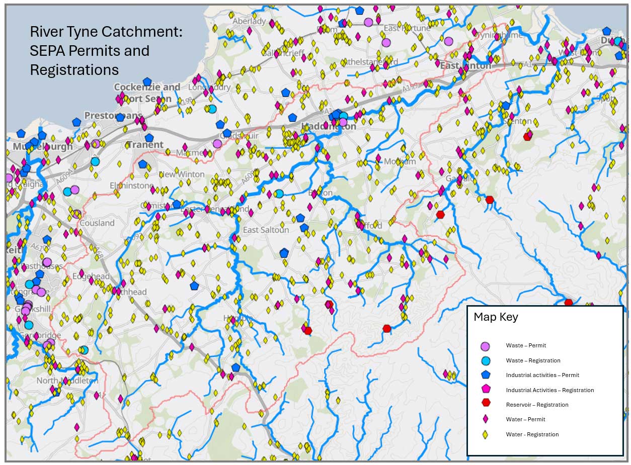
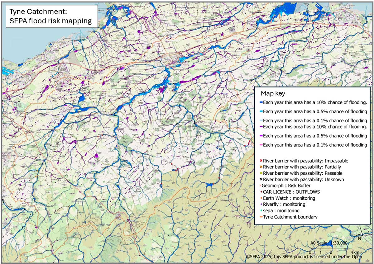
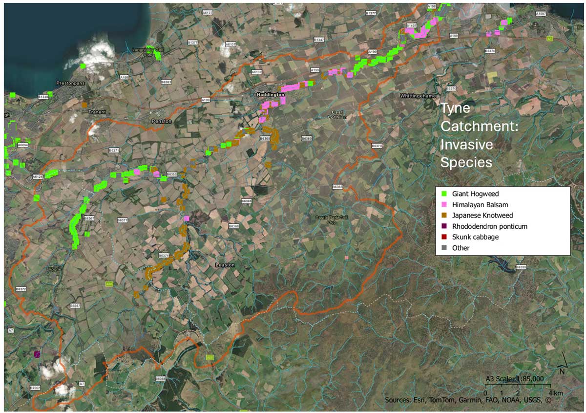
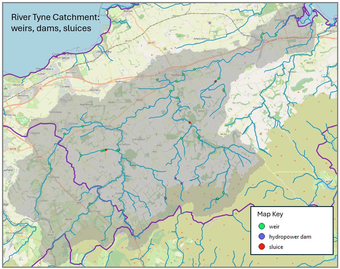
Over the summer of 2026 we are pulling together data and information about the catchment – see the maps below. However local knowledge is also hugely valuable to this work and we would like to hear from anyone who would like to contribute to these plans. We are particularly interested in hearing about areas impacted by:
- River or surface water flooding
- Riverbank erosion
- A lack of riverside trees or woodland
- Agricultural (diffuse) pollution
- Sewage outfalls, other discharge points or water quality concerns
- Barriers to fish passage
We would also like to identify opportunities for:
- Wetland or pond creation
- Riverbank planting or wider buffer strips
- Natural flood management measures
Get Involved
If you are aware of any issues affecting the River Tyne catchment, or have ideas for restoration opportunities, we would love to hear from you.
Please contact Mike Thornton, Project Lead, at mike@balancedhorizon.org
When getting in touch, it could be helpful if you are able to provide:
- Your name and contact details
- A description of the issue or opportunity
- The location, preferably with an Ordnance Survey grid reference or What3Words reference
Looking Ahead
Over the coming year we will be developing a programme of river restoration projects across the Tyne catchment. Our ambition is to help create a healthier, more diverse and resilient river system that delivers benefits for people, wildlife and communities through cleaner water, enhanced habitats and reduced flood risk.
The following maps show key datasets we have for the catchment.